Amravati (Amrāvati)
Amravati (pronunciation (help·info)) is the second largest city in the Vidarbha region and ninth largest city in Maharashtra, India. It is administrative headquarters of Amravati district and Amravati division which includes Akola, Buldhana, Washim, and Yavatmal districts. It is one of the Maharashtra's nominated city under Smart Cities Mission.
The ancient name of Amravati is “Udumbravati”, prākrut form of this is “Umbravati” and “Amravati” is known for many centuries with this name. Amravati is the incorrect pronunciation of this, and as a result, it now goes by that name. Amravati is claimed to have gotten its name from the city's historic Ambadevi temple. The stone inscription on the base of the marble statue of God Adinath (Jain God) Rishabhanath serves as an Old Testament of Amravati's existence. This demonstrates that these statues were erected in this location in 1097. When Govind Maha Prabhu visited Amravati in the 13th century, Warhad was ruled by the Hindu King of Devagiree (Yadav)
Famine (drought) struck Amravati in the fourteenth century, and residents fled to Gujarat and Malwa. After several years, the locals were brought back to Amravati, where the population was sparse. Mager Aurangpura, now known as "Sabanpura," was given to jumma masjid by Aurangzeb in the sixteenth century. This demonstrates that Muslims and Hindus coexisted in this area. When Amravati had become known as Bhosle ki Amravati in 1722, Chhatrapati Shahu Maharaj gave Amrāvati and Badnera to Shri Ranoji Bhosle. The city was reconstructed and prospered by Ranoji Bhosle after the treaty of Devgaon and Anjangaon Surji and victory over Gavilgad (Fort of Chikhaldara).
The Amravati residents still refer to the location where the British general Colonel Wellesly camped as a camp. At the conclusion of the 18th century, the city of Amravati was founded. Amravati was governed by the Nizam and Bosale union state. Although the revenue officer was appointed, the defense system suffered. British forces took control of Gavilgad Fort on December 15, 1803. According to the Deogaon pact, Nizam received the Warhād as a sign of friendship. Pindāri invaded Amravati city in or around 1805.
In 1983, Amravati became Vidarbha's second Municipal corporation. Located about 663 (412 mi) kilometers east of the state capital Mumbai and 152 (94 mi) kilometers west of Nagpur, Amravati is the second largest city of the Vidarbha region after Nagpur.
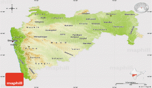
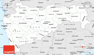
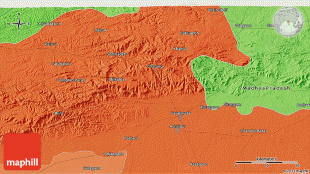
Amravati is located at 20.93°N, 77.75°W. It has an average elevation of 343 meters (1125 feet). It lies 156 km west of Nagpur and serves as the administrative centre of Amravati District and of Amravati Division. The city is located near the passes through the hills that separate the cotton-growing regions of the Purna basin to the West and the Wardha basin to the East. Chikhaldara is about 80 km from Amravati city which is the only hill station in the Vidarbha region. The land area of the city is around 183.5 km2.
The ancient name of Amravati is “Udumbravati”, prākrut form of this is “Umbravati” and “Amravati” is known for many centuries with this name. Amravati is the incorrect pronunciation of this, and as a result, it now goes by that name. Amravati is claimed to have gotten its name from the city's historic Ambadevi temple. The stone inscription on the base of the marble statue of God Adinath (Jain God) Rishabhanath serves as an Old Testament of Amravati's existence. This demonstrates that these statues were erected in this location in 1097. When Govind Maha Prabhu visited Amravati in the 13th century, Warhad was ruled by the Hindu King of Devagiree (Yadav)
Famine (drought) struck Amravati in the fourteenth century, and residents fled to Gujarat and Malwa. After several years, the locals were brought back to Amravati, where the population was sparse. Mager Aurangpura, now known as "Sabanpura," was given to jumma masjid by Aurangzeb in the sixteenth century. This demonstrates that Muslims and Hindus coexisted in this area. When Amravati had become known as Bhosle ki Amravati in 1722, Chhatrapati Shahu Maharaj gave Amrāvati and Badnera to Shri Ranoji Bhosle. The city was reconstructed and prospered by Ranoji Bhosle after the treaty of Devgaon and Anjangaon Surji and victory over Gavilgad (Fort of Chikhaldara).
The Amravati residents still refer to the location where the British general Colonel Wellesly camped as a camp. At the conclusion of the 18th century, the city of Amravati was founded. Amravati was governed by the Nizam and Bosale union state. Although the revenue officer was appointed, the defense system suffered. British forces took control of Gavilgad Fort on December 15, 1803. According to the Deogaon pact, Nizam received the Warhād as a sign of friendship. Pindāri invaded Amravati city in or around 1805.
In 1983, Amravati became Vidarbha's second Municipal corporation. Located about 663 (412 mi) kilometers east of the state capital Mumbai and 152 (94 mi) kilometers west of Nagpur, Amravati is the second largest city of the Vidarbha region after Nagpur.
Amravati is located at 20.93°N, 77.75°W. It has an average elevation of 343 meters (1125 feet). It lies 156 km west of Nagpur and serves as the administrative centre of Amravati District and of Amravati Division. The city is located near the passes through the hills that separate the cotton-growing regions of the Purna basin to the West and the Wardha basin to the East. Chikhaldara is about 80 km from Amravati city which is the only hill station in the Vidarbha region. The land area of the city is around 183.5 km2.
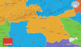
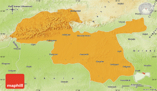
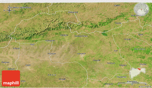
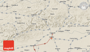
Map - Amravati (Amrāvati)
Map


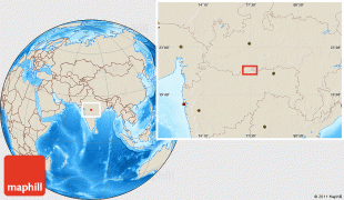
Country - India
 |
 |
| Flag of India | |
Modern humans arrived on the Indian subcontinent from Africa no later than 55,000 years ago. Their long occupation, initially in varying forms of isolation as hunter-gatherers, has made the region highly diverse, second only to Africa in human genetic diversity. Settled life emerged on the subcontinent in the western margins of the Indus river basin 9,000 years ago, evolving gradually into the Indus Valley Civilisation of the third millennium BCE. By, an archaic form of Sanskrit, an Indo-European language, had diffused into India from the northwest. (a) (b) (c), "In Punjab, a dry region with grasslands watered by five rivers (hence ‘panch’ and ‘ab’) draining the western Himalayas, one prehistoric culture left no material remains, but some of its ritual texts were preserved orally over the millennia. The culture is called Aryan, and evidence in its texts indicates that it spread slowly south-east, following the course of the Yamuna and Ganga Rivers. Its elite called itself Arya (pure) and distinguished themselves sharply from others. Aryans led kin groups organized as nomadic horse-herding tribes. Their ritual texts are called Vedas, composed in Sanskrit. Vedic Sanskrit is recorded only in hymns that were part of Vedic rituals to Aryan gods. To be Aryan apparently meant to belong to the elite among pastoral tribes. Texts that record Aryan culture are not precisely datable, but they seem to begin around 1200 BCE with four collections of Vedic hymns (Rg, Sama, Yajur, and Artharva)."
Currency / Language
| ISO | Currency | Symbol | Significant figures |
|---|---|---|---|
| INR | Indian rupee | ₹ | 2 |
| ISO | Language |
|---|---|
| AS | Assamese language |
| BN | Bengali language |
| BH | Bihari languages |
| EN | English language |
| GU | Gujarati language |
| HI | Hindi |
| KN | Kannada language |
| ML | Malayalam language |
| MR | Marathi language |
| OR | Oriya language |
| PA | Panjabi language |
| TA | Tamil language |
| TE | Telugu language |
| UR | Urdu |